geotiff viewer
This application software is valid only for image files shown below.
- one or two byte data
- Geographic latitude and longitude coordinates and UTM ma projection
- geotiff format
Note: All ASTER image files generated using silcast300 software can be read by this geotiff viewer.
 Function Overview Function Overview
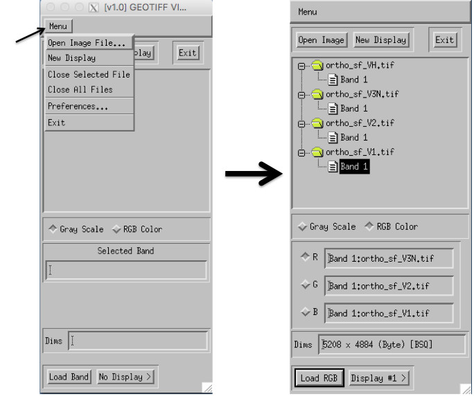 |
| Input image file import window | One example of imported files |
|
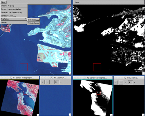 |
| One example of two displayed images |
Functions for displayed images
- Linkage for plural imges
- Cursor location value
- Interactive stretching
- Contour
- X and Y profiles
Supported operatiing systems
- Windows 7 or later
- Macintosh OSX 10.12 or later
- Linux (Special Order)
|